|
CAPTAIN ACCURATE'S WEATHER
TIMELINE |

|


|
"APRIL showers bring MAY flowers." Knoxville averages 4.01" of rain for the whole month of April. So far, McGhee Tyson Airport has only received 0.18" of rain during the first 11 days of April. For East Tennessee...my forecast has NOT changed. *** I am expecting 1 to 3" + of RAIN to fall on Easter afternoon and night, with locally HIGHER amounts, and where flash flooding could be an issue. *** Here's my view of the most recent RAINFALL models for Easter. For purposes here, the "circles" below, in most cases, refer to 3, 4, 5 or more inches of rain. Hope this helps. ---Captain Accurate 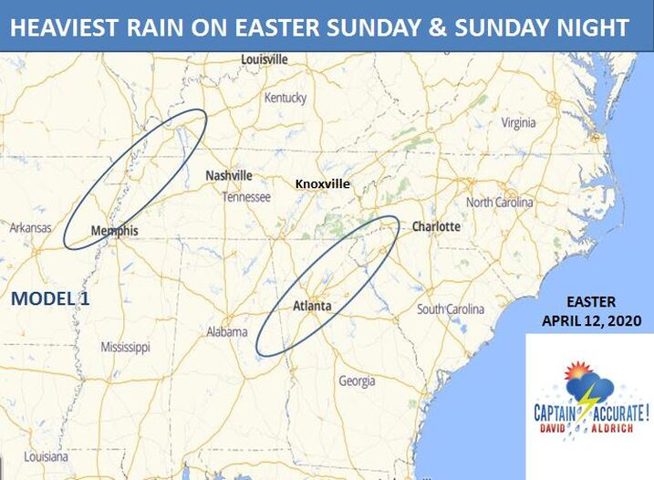 MODEL 1 usually underplays these types of weather situations.  MODEL 2 is by far and away the most aggressive, suggesting 3 to 6"+ of rain. I think it's too exaggerated. I'm calling MODEL 2 the "crazy rain train." 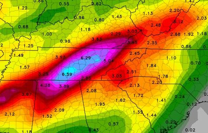 Model 2: "crazy rain train" Picture Courtesy from College of Dupage, 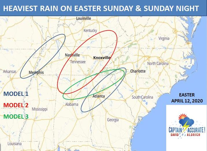 MODEL 3 tends to be more reasonable, and in this instance, is a good blend of MODEL 1 and 2. 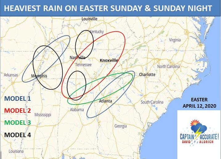 MODEL 4, just like MODEL 3, is a more reasonable solution. The absolute worst of this storm should be to our South and West. Having said that, winds will kick into high gear here later Sunday night, and of course for the Smokies. 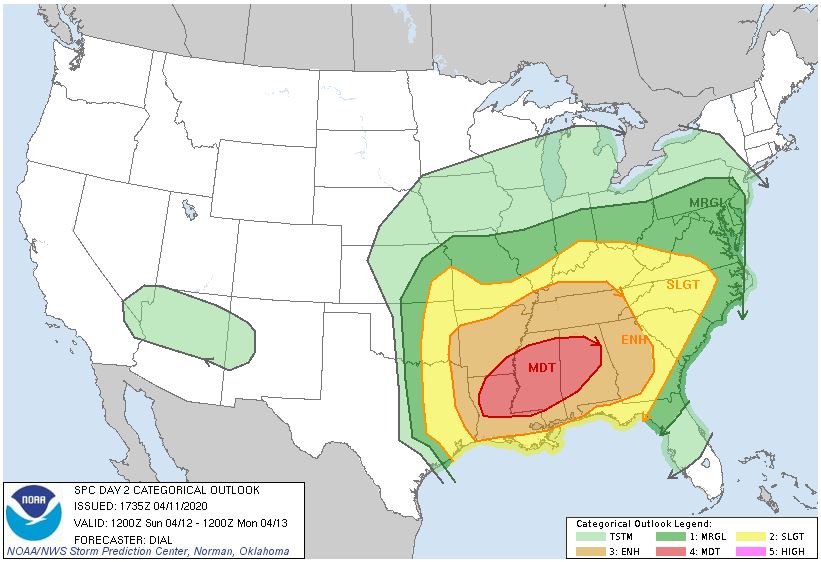 From the Storm Prediction Center for 8 AM Easter Sunday to 8 AM Monday 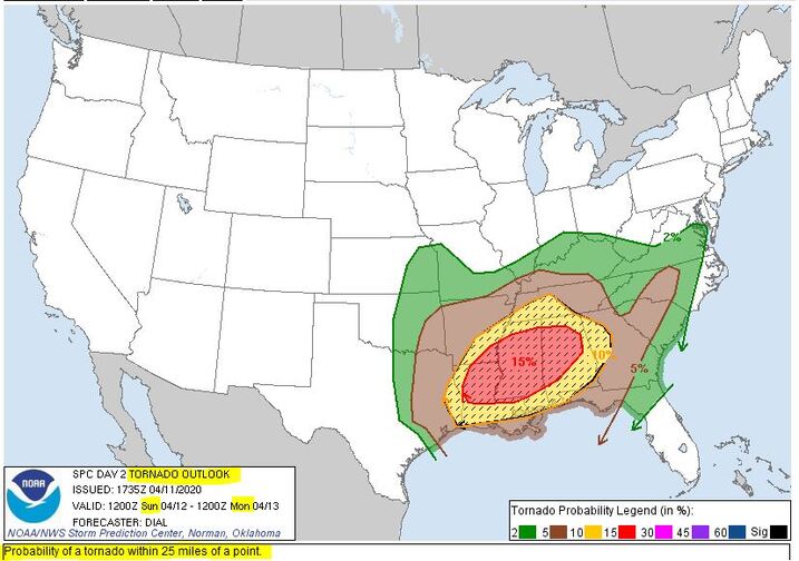 Tornado Outlook from the Storm Prediction Center for 8 AM Easter Sunday to 8 AM Monday But what about Tornadoes ??? From the Storm Prediction Center ."..TN Valley into the OH Valley -- Sunday night... Substantial uncertainty remains regarding the potential for destabilization from northern portions of the TN Valley into the OH Valley, due to the potential for widespread convection to the south of this area. However, rapidly strengthening wind fields in advance of the deepening cyclone will support the potential for damaging wind and perhaps a tornado risk by Sunday evening should even modest destabilization occur, as strong convection attempts to move in from the southwest in tandem with the deepening cyclone." https://www.spc.noaa.gov/products/outlook/day2otlk.html It's not easy being Accurate #CaptAccurateWx Need a weather app you can rely on? Check out the Captain Accurate Weather App. It gives you instant severe weather alerts, lightning alerts and MORE, straight to your phone or iPad with NO delay. It's FREE. Just search: Captain Accurate at the App Store and Google Play. Special thanks to Fox Toyota in Clinton for making it possible.

0 Comments
Leave a Reply. |
David AldrichCaptain Accurate Weather Archives
July 2024
Categories |
 RSS Feed