|
Additional Rainfall to Expect, based on data from Wednesday morning
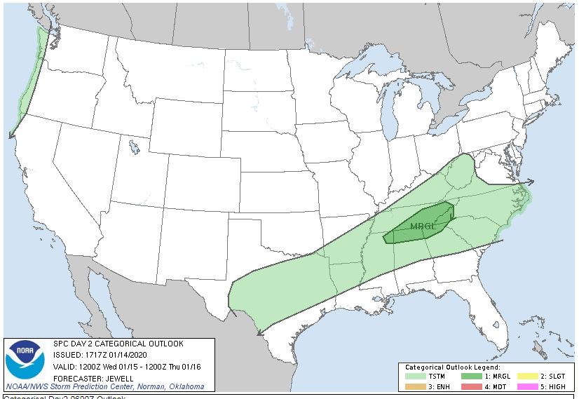
Model A: 0.26" Model B: 0.16" Model C: 0.52" 3 Model Average: 0.313" Naturally, you can expect some locally higher amounts. Wednesday: Morning fog, mostly cloudy, some hazy sun, scattered showers and storms, 60% chance, some could be strong to severe, particularly in the afternoon and evening. Hail and damaging wind may result. Look for highs in the upper 60s to near 70°. Record high is 72° from 1907, back when Theodore Roosevelt was President. Wednesday night:. More showers and storms, 60% chance, cooler, lows in the mid to upper 40s. Thursday: Becoming mostly sunny. Lower to mid 60s after midnight, daytime highs in the lower to mid 50s. An "Upside down" day For my latest 7 Day Forecast, check out the Captain Accurate Weather App. So weather does not surprise you #CaptAccurateWx A MARGINAL (or isolated) risk for severe storms is in effect for East Tennessee on Wednesday from the Storm Prediction Center https://www.spc.noaa.gov/products/outlook/day2otlk.html P.S. If you find these independent forecasts and posts helpful, please consider downloading my NEW Captain Accurate Weather App. It's FREE. Just search: Captain Accurate at the App Store and Google Play. It comes with 5 FREE App Tutorials, so you can quickly learn all the wonderful things it can do.. www.CaptainAccurate.com
1 Comment
|
David AldrichCaptain Accurate Weather Archives
July 2024
Categories |


 RSS Feed