|
“Ladies and gentlemen, please remain seated until the Captain turns off the Fasten Seat Belt sign.” It's going to be a "wet snow" ride.
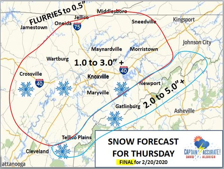
The aggressive NAM (North American Mesoscale) model, generated here in the United States, still has 3 to 4" + of wet snow for Knoxville and its surrounding East Tennessee counties for Thursday. That means expect accumulation, especially on grassy surfaces, patio, deck furniture and cold car roof tops, for example. Snow covered roads are more likely to develop in the Smokies where it's naturally colder. Model Timeline for Knoxville: 6 AM to 9 AM......RAIN (yes, rain) 10 AM to 5 PM....WET SNOW (yes, wet snow) and FLURRIES This model output comes from tonight's 7 PM run. Just a heads up. My FINAL Snow Map has NOT changed. See below. It was posted just before 4 PM today, and is located here on CaptainAccurate.com. ---signed Captain Accurate www.CaptainAccurate.com
1 Comment
2/20/2020 02:19:02 pm
Love Your Weather Blog David!!! Wish you were still on TV but I'll take what I can Get!!! Miss You Man.
Reply
Leave a Reply. |
David AldrichCaptain Accurate Weather Archives
July 2024
Categories |


 RSS Feed