|
CAPTAIN ACCURATE'S WEATHER
TIMELINE |

|


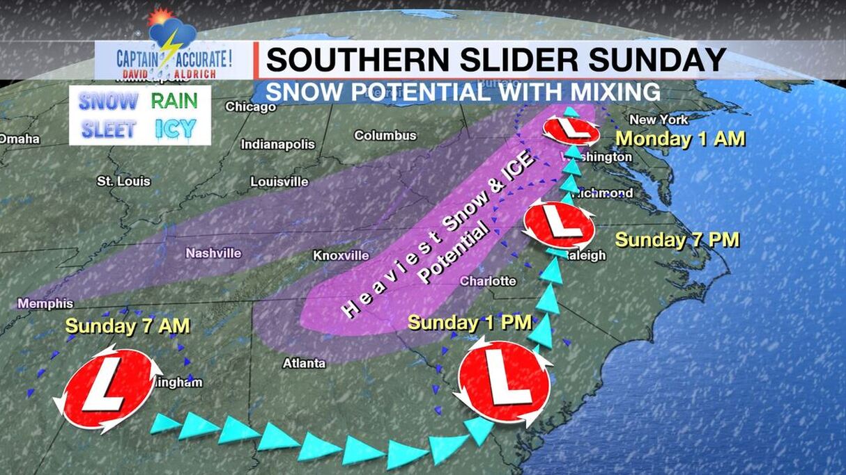 From NWS-Morristown Rainfall amounts for East Tennessee from Today through Saturday: 1-3"+ with locally higher amounts. Localized flooding could be an issue. Turn Around, Don't Drown! NEW Thursday model data Model A...2.80" Model B...2.72" Model C...1.95" 3 Model Average: 2.49" Sunset 5:34 PM Tonight: Cloudy, periods of heavy rain, 100% chance, lows in the lower to mid 40s and RISING to near 50° around sunrise. Friday: Rainy, cloudy, 80% chance, highs near 60°. Friday night: More rain, steady at times, 80% chance, lows near 50°. Saturday: Mostly cloudy, rain showers, 60% chance, gusts around 30 mph in the Valley, early daytime highs in the lower 50s and FALLING into the 40s and then 30s by the afternoon. Saturday night: Decreasing clouds, light rain and drizzle ending with some flurries, 20% chance, COLDER, lows in the upper 20s. Sunday: Mostly sunny, highs in the upper 40s. Sunday night: Starry skies, lows in the lower 30s. Monday: Mostly sunny, highs in the lower 50s. So weather does not surprise you #CaptAccurateWx P.S. If you find these independent forecasts and posts helpful, please consider downloading my NEW Captain Accurate Weather App. It's FREE. Just search: Captain Accurate at the App Store and Google Play. It comes with 5 FREE App Tutorials, so you can quickly learn all the wonderful things it can do.
0 Comments
Leave a Reply. |
David AldrichCaptain Accurate Weather Archives
July 2024
Categories |

 RSS Feed